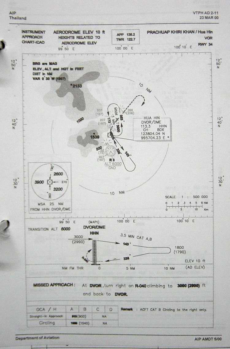
| Name: Hua Hin Airport - VTPH |
| Coordinates: N12*37.8' x E099*57.2' |
| Frequency:
APP-126.2 or 126.6 / TWR-122.7 / GND-121.9 |
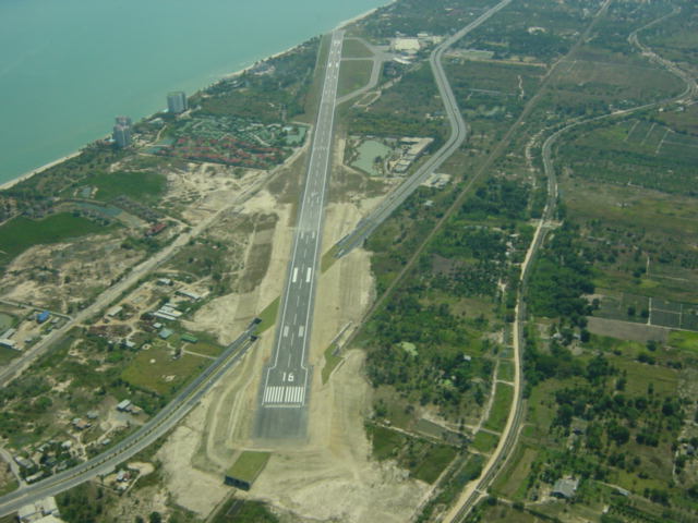
| Runway Heading: 16/34 |
| Length: 2,100
meter (35 meter wide) |
| Surface: tarmac |
| Slope: none |
| Elevation: 10' |
| Obstructions: none |
| Runway PAPI: on rwy 16 and 34 (3 degree approach) |
| Location: Hua Hin Airport is on the west side of the Gulf
of Thailand. It is approximately 65 NM from Bang Phra across the water |
| Activities: Hua Hin is the home of
the Civil Aviation Training Center. It is a fun town to fly to and the
airport is very modern. |
| Contact Information: 032+520343
// |
| Navaids: NDB-213(HN) / VOR-113.3
// |
| Reporting Points: (from the North or East)
call over 'wharf' (charlie point) which is approx 11 DME on R-012 of HHN VOR.
(from the South or West) call over Amphoe Pranburi (papa point) which is approx
15 DME on R-200 of HHN VOR. |
| Operation Hours: call the airport or check
NOTAMS for operation times as the airport has been under construction and times
of usage vary. |
| Caution: His Majesty The King's Palace is off the end of
Runway 16. It is prohibited to fly over the palace. It is not marked on the
maps, and it is not easily known about this regulation, but it is a very sensitive
area that you must not fly over. It is approximately 4 km from the end
of the runway on the coast. |
| Map of Airstrip:
http://www.aisthai.go.th/webais/pdf/AERONAUTICALCHARTS/VTPH.pdf |