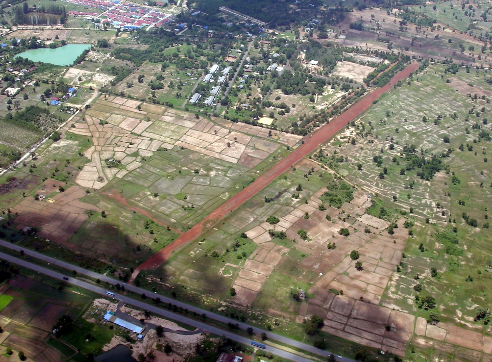
| Name: Nang Rong Airport |
| Coordinates: 14*37' N x
102*46.5' E |
| Frequency: |
| Runway Heading: NE/SW |
| Length: |
| Surface: Laterite |
| Slope: none |
| Elevation: ??' |
| Obstructions: n/a |
| Location: Southwest of
Buriram // disused Military airstrip. |
| Activities: Near the
Khmer ruins 10NM to the Southeast. // Phanom Rung Khmer Ruins // very
beautiful historic site // |
| Contact Information: |
| Other links: For additional information: DOA
Aeronautical Information Service, Tung Mahamek, Bangkok 10120, Thailand --
tel: 02 256 0922 // 02 286 0922 // fax: 02 287 4060 // AFTN: VTBAYOYX. |
| Map of Airstrip: |
|