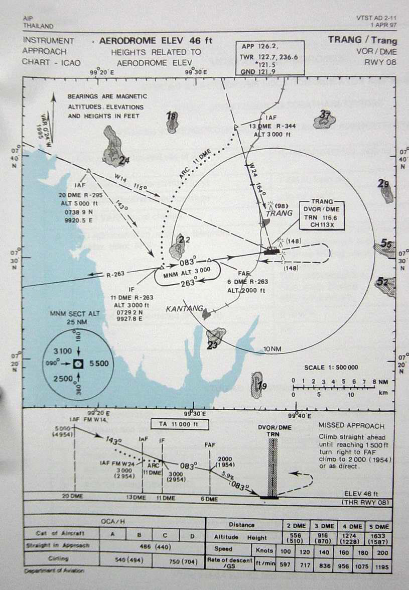
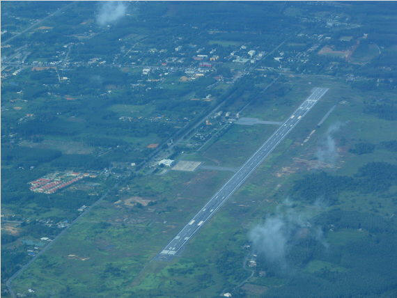
| Name: Trang Airport - VTST |
| Coordinates: 07*30.5' N x
099*37.5' E |
| Frequency: 125.3 approach // 118.4 tower |
| Runway Heading: 08/26 |
| Length: 2,100 meters |
| Surface: tarmac |
| Slope: none |
| Elevation: 46' |
| Obstructions: n/a |
| Location: 7km South of city |
| Activities: |
| Contact Information: |
| Other links: For additional information: DOA
Aeronautical Information Service, Tung Mahamek, Bangkok 10120, Thailand --
tel: 02 256 0922 // 02 286 0922 // fax: 02 287 4060 // AFTN: VTBAYOYX. |
| Map of Airstrip:
http://www.aisthai.go.th/webais/pdf/AERONAUTICALCHARTS/VTST.pdf |
Thank you Kevin Muk for photos.
|