CHAIYAPHUM AIRPORT
| Name: Chaiyaphum Airport - VTUC |
| Coordinates: 15*48' N x 102*01' E |
| Frequency: |
| Runway Heading: 05 / 23 |
| Length: 3,400' (150' wide) |
| Surface: laterite |
| Slope: none |
| Elevation: 610' |
| Obstructions: n/a |
| Location: West of Chaiyaphum |
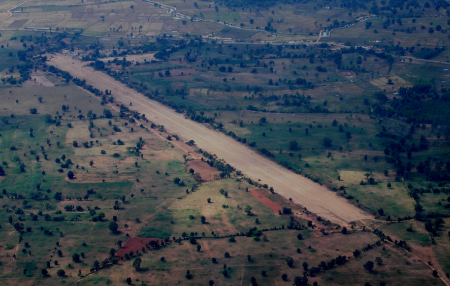
| Activities: UPDATE (Sep2012) -- This airfield is in vicinity of Muang District of Chaiyaphum Province (9 kilometer from downtown). It might be upgrade or renovation to use for sport aviation activity in the future for Chaiyaphum area. Runway is still good for light aircraft (under 3-4 tons), approximately 45 meters wide and 1,300 meters long (1,200 meters usable), Rwy 06 is up hill and Rwy 24 is down hill., It's really wet and soft field when raining season (see wheel trace in the picture). Taxi way is fill with mud and grass, Apron area is approximately 25x50 meters. No any obstruction or tree at the middle of the runway seem to be in google earth. From: Rakop Kunhasin -- rakop@yahoo.com |
| Contact Information: Military ID: T-58 / 1:250,000 map sheet ND 48-1 airfield shown here: http://www.nexus.net/~911gfx/vietnam/maps/nd48-01/nd48_01a.html (FYI, the Air America site book for Thailand is incorrect, it shows "ND 49-1" for the map sheet, should be "ND 48-1."). This is an RTAF airstrip. Remarks: Open to C-46, 350' sod overrun E end. Approach to rwy 23 over numerous 40' buildings, antennas and smoke stacks 1,500' from threshold, dry creek 600' from threshold. Status undetermined for C-130. 500'x35' laterite parking area E of runway. (Note: this "RTAF" field is just a bit west of Chayaphum town so looks to me like the one you have on your www site is this one: http://thaiflyingclub.com/linkairportchaiyaphum.html ). Thanks Mac for info. |
| Other links: For additional information: DOA Aeronautical Information Service, Tung Mahamek, Bangkok 10120, Thailand -- tel: 02 256 0922 // 02 286 0922 // fax: 02 287 4060 // AFTN: VTBAYOYX. |
| Map of Airstrip: |