| Name: Saraburi Tango
Squadron Airport -- CLOSED |
| Coordinates: 14*26.5' N x
101*00.9' E |
| Frequency: 122.775
(unofficial) / monitor 122.3 (for safety) |
| Runway Heading: 11 / 29 |
| Length: 1,040meters |
| Surface: |
| Slope: none |
| Elevation: ??' |
| Obstructions: n/a |
| Location:
http://www.thai-aviation.net/files/Tango_Squadron.pdf |
| Activities: Tango
Squadron. Over 30 L-19/O-1 aircraft.
List of Tango
Aircraft -- UNUSED -- OVERGROWN (aug 2014) |
| Contact Information:
Airport belongs to Khun Tang and his cousin P'Nid. The L-19s/O-1s look nice
all spread out and with wings on them!! Much better than at the old
location, stripped and close up. 30+ O-1s! The park location also looks nice
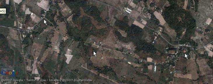
and they even have a UBC dish at the "restaurant" area. Sat photos are from
www.flashearth.com, show the turn off from the paved road to the
CONCRETE road (not "dirt" as on the Foundation map). Also a photo from the
turn-off, first arrow, to the the aero park, second arrow, to Wat Nong Song
Hong, third arrow. Note, when driving in, you come to the camping park on
the left then a short distance on to the O-1s on the right. BTW, when coming
in from the Friendship Highway, the entrance area to Wat Phuta Chai is about
Km 101 but you have to keep going north to Saraburi to find a U-turn. It's
then about: -- 5 km from the highway to a Y intersection, go right
then, do not take Hwy 3246 but go left through the wat
parking area, exit out the back where you'll pass a couple cell phone
towers, and continue straight about -- 7 km on the half way decent
paved road to the turn off on to the concrete road to the parks. As
described, you'll pass over the RR tracks shortly before turning right into
the concrete road. (revised aug07) |
| Other links: For additional information: DOA
Aeronautical Information Service, Tung Mahamek, Bangkok 10120, Thailand --
tel: 02 256 0922 // 02 286 0922 // fax: 02 287 4060 // AFTN: VTBAYOYX. |
| Map of Airstrip: |

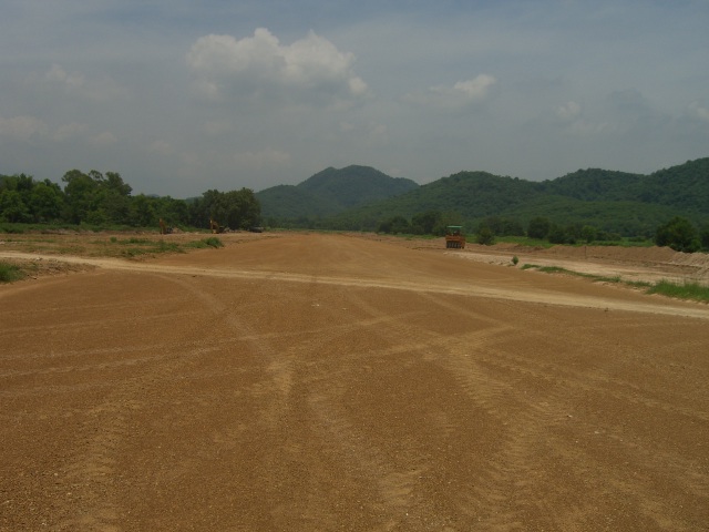
Saraburi Tango Aeropark -- Looking East
|

